Description
Product introduction
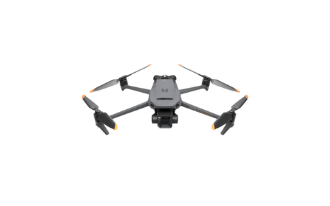
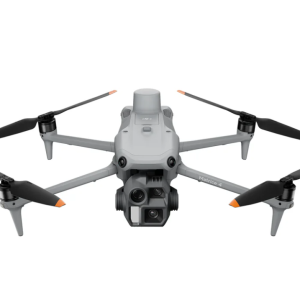
DJI Mavic 3E is a portable enterprise mapping drone for survey capture, construction documentation, site progress, and daylight visual inspection. Its compact folding airframe is designed for field teams that need fast deployment without moving to a heavy multi-payload platform.
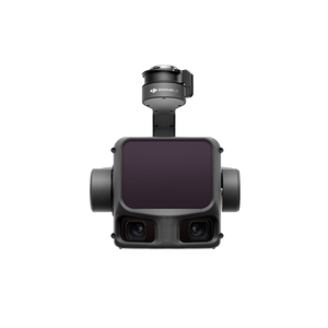
The 4/3 CMOS wide camera combines 20 MP resolution with a mechanical shutter, making Mavic 3E the mapping-focused aircraft in the Mavic 3 Enterprise Series. A tele camera supports visual confirmation from a safer working distance, while optional RTK support can strengthen repeatability and geospatial workflows.
Key features
- 4/3 CMOS 20 MP wide camera with a mechanical shutter for efficient survey image capture.
- 12 MP tele camera for visual inspection and contextual confirmation.
- RTK module support for workflows that require repeatable positioning.
- Up to 45 minutes of flight time under the stated test conditions.
- Portable enterprise form factor for crews moving between multiple sites.
Best applications
Mavic 3E is best suited to photogrammetry, topographic survey capture, construction progress, stockpile documentation, roof and facade imaging, daylight infrastructure inspection, and rapid site records. It is not a thermal aircraft; teams that require temperature data, night response, or thermal anomaly detection should compare the DJI Mavic 3T thermal drone.
Technical highlights
The listed product configuration includes a 4/3 CMOS 20 MP mechanical-shutter wide camera, a 12 MP tele camera, RTK module support, and up to 45 minutes of flight time. Actual endurance, image quality, and achievable survey accuracy depend on altitude, overlap, speed, lighting, positioning, control points, processing method, weather, and local flight rules.
Compatible DJI Enterprise solutions
Plan the aircraft together with batteries, charging, controller, RTK equipment, storage, and the required processing workflow. Compatible DJI FlightHub 2 fleet and mapping functions vary by aircraft, region, and service plan, so licensing and required outputs should be confirmed before purchase.
Who is this product for?
Mavic 3E is intended for survey crews, construction teams, engineering firms, inspection contractors, and enterprise operators who prioritize portability and mapping capture. Buyers needing weather protection, heavier payloads, or a dock-based autonomous workflow should compare larger Matrice or DJI Dock platforms.
Request a quote or deployment consultation
For an accurate quotation, describe the mapping area, required output, accuracy target, working environment, and delivery destination.
- Confirm aircraft quantity, battery count, charging, controller, and RTK requirements.
- State the intended mapping, inspection, or mixed workflow and expected deliverables.
- Include destination country, schedule, training needs, and software requirements.
Published performance figures are based on DJI test conditions and existing product information. Confirm regional compatibility, accessories, software, and delivered package before purchase.
Reviews
There are no reviews yet.